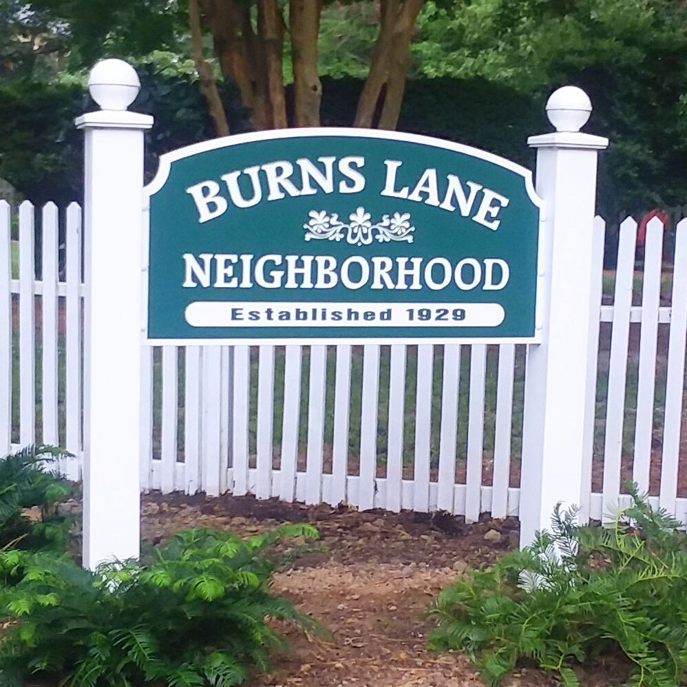
Whether or not you buy Freud’s argument that “Anatomy is Destiny,” I hope, after reading this post, you agree that for the Burns Lane neighborhood, geography is destiny.
Thesis: Much of the history of our bit of land has been determined by its location between two ravines, one between Burns Lane and Indian Springs and the other running behind Powell and Goodwin.
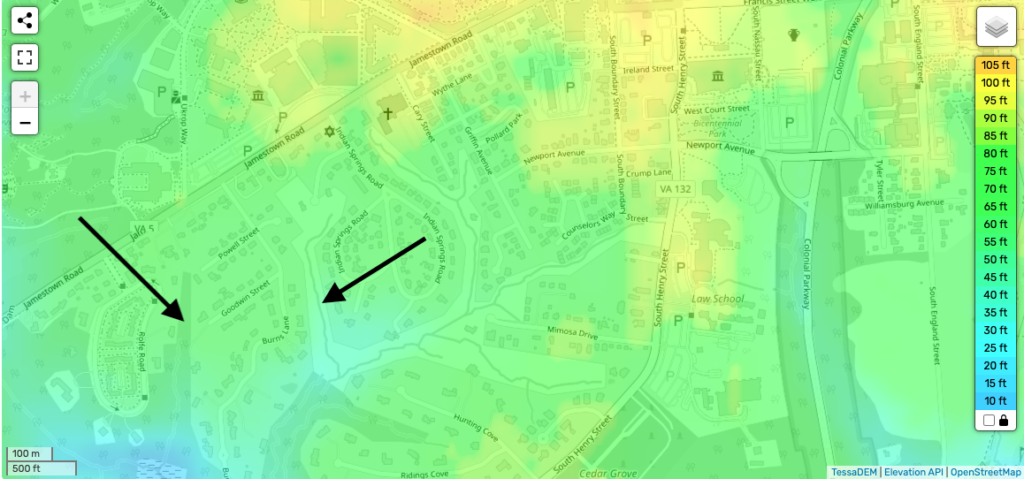
Take a look at the topographic map of the area and you will see the distinct change in altitude from about 80′ to about 35′, which is why Ed and Glenda’s parkland hosts a raging torrent when we get any significant rain.
Why do I say these ravines determine our destiny? Husband Bill and I sat down with neighbor Bill Kelso the other evening and chatted about his neighborhood historical findings. Bill has unearthed and interpreted a number of documents that show how Burns Lane evolved. Most of the images in this article were collected and annotated by him. Surprisingly, Bill was unhappy because he found little documentation about Burns Lane before the 20th century. The more we discussed what historical evidence he did find, the more likely it seemed to me that there just wasn’t much written history to discover.
Why?
I say it’s because of those dratted ravines.
Disclaimer in advance: the opinions in this post are mine alone. If you disagree with things I’ve said, or are miffed about things I’ve left out, please don’t accost Bill. I take full responsibility. Leave corrections or comments below and please share your sources so we can build an archive of BLC historical resources.
Prehistory
I’m going to use the term ‘prehistoric’ in its technical sense, meaning before written records. Let me be clear that I’m not claiming Native Americans were primitive. I’m merely stating the fact that they did not leave written records. Because Pre-English cultures in the American mid-Atlantic were prehistoric, archaeological findings, cultural stories and beliefs via oral traditions, and in some cases lingering place names, are our only views into the time before the English arrived.
Bill K told me that there is very little archaeological evidence of prehistoric human occupation near here. He theorizes that native inhabitants in the Late Woodland Era (900 – 1650 CE) used what is now Burns Lane as a hunting ground rather than as a settlement area. This theory is backed up by later documentation, as you will see.
The Early 17th Century
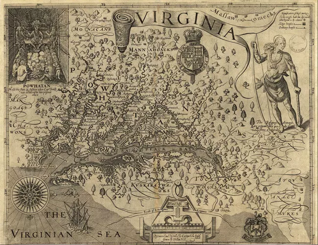
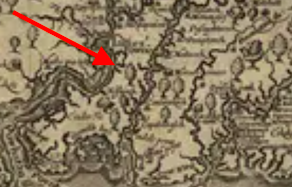
The earliest map we have of this area is John Smith’s map of 1612. What will become Burns Lane is denoted by a tree (see the closeup below) whereas other, more accessible nearby areas, specify pre-English villages. Assuming Smith was accurate, at the time of the Jamestown settlement, our neighborhood was heavily-wooded uninhabited land.
Uninhabited, but not wilderness. The name “Indian Springs” signifies pre-English use of fresh water resources across the ravine from here. This map backs up Bill’s theory that the local tribes didn’t have a permanent settlement, but probably did use the area as a hunting ground and a source of fresh water. (Would you want to drink water from College Creek?)
Of course we have to ask, “Why?” Why have settlements in other nearby locations and not here?
I believe the answer is the ravines. This jut of dry land between two low-lying, boggy and mosquito-ridden wetlands would have been miserable to live in and inconvenient for travel to other resource areas. Consider how many of our current homes have odd elevation changes, flooding problems, and downright weird property lines. Without bulldozers, tractors and other industrial-age tools, building a village here would be a nightmare.
Hunting? Sure. Home building? Not so much.
Rich Neck and Middle Plantation
When the English first started to occupy land around College Creek, we know there was a plantation called Rich Neck in the Holly Hills area. This map from Research Gate shows that the plantation only went as far east as College Creek and did not include what would become Burns Lane. (Of course this map was drawn in the 20th century based on 17th century documentation, so I suppose we need to keep an open mind.)

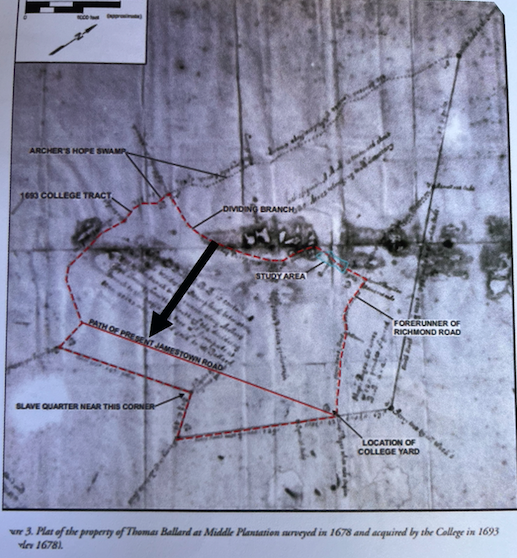
The Middle Plantation survey map of 1678 shows the plantation included a bit of upper Burns, but not what would become the entire neighborhood. Even Middle Plantation didn’t want our poor bit of dry land. (Sorry about the terrible resolution. This is a photo of a PP slide.)
Why claim land up to, but not including this area?
I’ll say it again: because of those pesky ravines. Without a way to clear or timber it economically, the land would simply be an unused resource. If you were trying to establish a farm, wouldn’t you rather claim land easy to develop?
The 18th Century
Not much changed in the next hundred years, except of course the colonies declaring independence and entering into a war with arguably the most powerful country in the western world. In 1781 our allies in that war, the French, commissioned a billeting map of the area to document topography, structures, and resources.
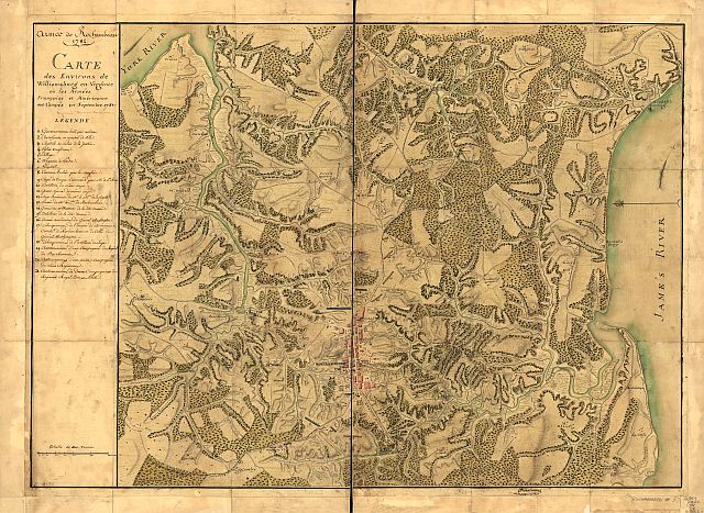
Desandrouin’s map is astonishingly detailed. It shows buildings, yards, earthworks, and French and American artillery and infantry positions. The map also shows that much of the area surrounding Williamsburg had been timbered.
Much but not all. The area that would become Burns Lane had no buildings and no earthworks. And clearly had not been timbered.
Again, why?
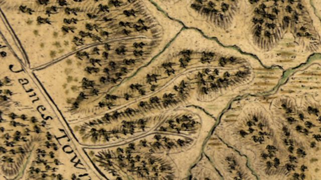
Probably because timbering in a ravine without modern machinery is a good way to get dead. Bill theorizes that the colonists, following in the footsteps of the native inhabitants, used the area as a hunting ground. At the time of the map’s publication, the future Burns Lane was still virgin forest.
The 19th Century and the Civil War
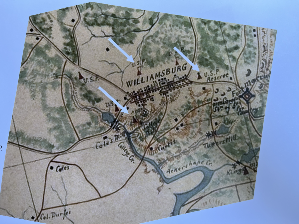
At last, signs of human occupation! This unattributed map from 1862 has the earliest evidence I’ve seen of a man made structure in our neighborhood. The farthest left arrow points to a picket down at the end of what would become Burns Lane. I’m told a phantom earthwork can still be seen today.
Note to neighbors: If anyone has documentation showing earlier occupation, and they would like to share, please post a comment and add the evidence as an attachment. I’m certain we would all like to see it.
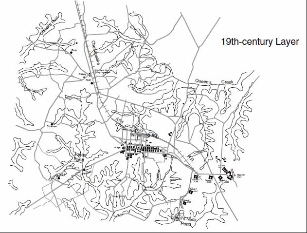
No longer untouched, but still unused, Burns Lane land remained vacant after the civil war. This map from the reconstruction era shows no development on the future Burns Lane, even though other nearby locations have buildings. If you are interested in reading more, you might find this online document, Williamsburg Cultural Resources Map Project of interest.
Why no development? I’ll let you guess what I think.
The 20th Century
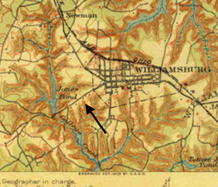
Finally, some development. This USGS map from 1906 shows buildings along Jamestown Rd, but nothing further back. It could be argued this is the first home in the neighborhood, even though only Jamestown Road exists.
Railroad enthusiasts should also note the tracks for the Chesapeake and Ohio passing north of the colonial area.
We have to cut to 1927 before we have photographic evidence of the area being cleared for farmland. Except for the ravines, all of the trees are gone. Which leads me to wonder, of all the varieties of trees to use for landscaping new home sites, why pick those practically purposeless, eternally littering, and landscape killing loblolly pines? Gak!
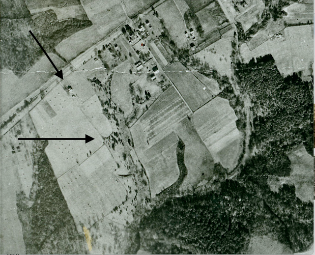
Sorry, back to the past. Look at this photo on the left to see some development south of Jamestown Rd. But alas, it isn’t Burns Lane. Rather, the Indian Springs area is starting to expand. Burns Lane still has a lone house on Jamestown Road with adjacent farmland.
Interestingly, at least to me, with the land cleared you can see the curve in the ravine forming a horn shape, that will force the curve on the now Burns Lane. Look where the bottom arrow is pointing to see what I mean.
Also, keep an eye out for that field boundary just below our lone farmhouse. It is possible that this boundary marks where Powell St. will eventually be located. Then again, it might not be. Where is the Allied Central Interpretation Unit when you need it?
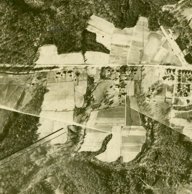
This unattributed 1931 photo is interesting because it was taken several years after the Rockefellers started to pour money into Colonial Williamsburg. Closer to the historic area a housing development is emerging, but back our way things are moving a bit more slowly. Indian Springs still has its sprinkling of buildings. But the big news is that it seems the field boundary we were looking at earlier may have turned into Powell, perhaps with a house on the corner.
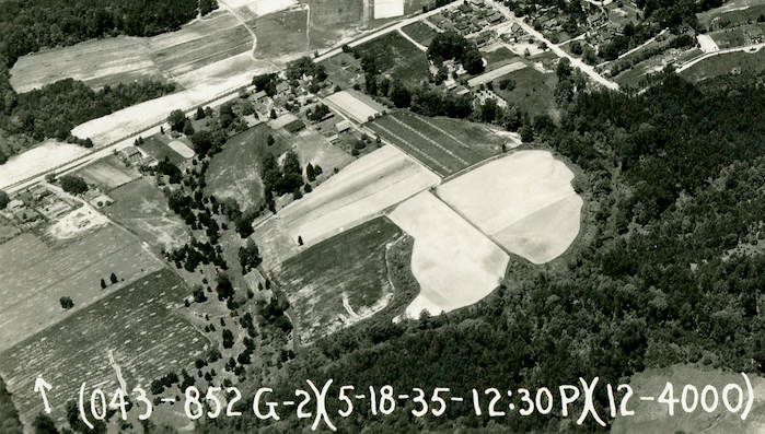
Cut to 1935 and there is a huge difference closer to the colonial area. Also, Indian Springs seems to have all of its roads, albeit probably more like gravel farm paths. Powell looks to be emerging both east and west of the farm track that will become Burns Lane.
I adore this 1949 aerial photograph for several reasons. First because it is marked with the restricted caveat. I assume this caveat wasn’t used to stop the Soviets from learning about Colonial Williamsburg. More likely because we didn’t want them, the Soviets, to know how good our aerial photography is. Was. Ah, the cold war.
I also love this photo because of how dramatic the changes are from pre-WWII. Williamsburg had become a city!
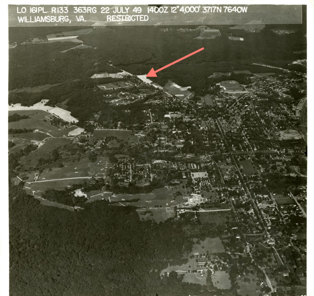
You can see our first view of Burns Lane in the zoomed image below, all empty and paved. (It may just be gravel.) Finally, here we are with both sides of Powell under development and our little jut of land between the ravines ready for a housing boom. The future Goodwin may be that unpaved farm path about half-way between Powell and the curve in Burns Lane.
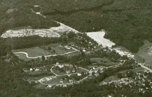
Look closer, however, and you can see we are very late to the party. On one side of us, Indian Springs has already been populated. “Well,” you might say, “That’s because Burns is further away from Williamsburg.”
That argument doesn’t hold water when you can see Rolfe Rd. had already been extensively developed. Something else had to be causing a lack of development here, and again I point to the problem of developing land for occupation on a narrow strip between two boggy ravines.
Burns Lane: the nerdy kid always picked last for a team in gym class.
Still, it’s a wonderful place to live, and her relative inaccessibility means we don’t get through traffic, and the neighborhood size is forced to be small. I would gladly trade a lack of historic documentation for a great place to live in the present.
What do you say, Bill?
What’s Next?
This isn’t the end. There are still many holes in the story. Who was this Burns person? When did all of the houses get built or moved? What about Goodwin? Who were the first residents?
All of these questions can probably be answered by digging around records at the courthouse, which I am emphatically not volunteering to do. And I believe Bill has done more than his fair share already. Is there anyone out there who has the time and inclination to pick up the story? Please let us know.
BLRA Webmaster
Chris Gareis
blrawebmaster
Bruce Sandkam
blrawebmaster
steven
blrawebmaster